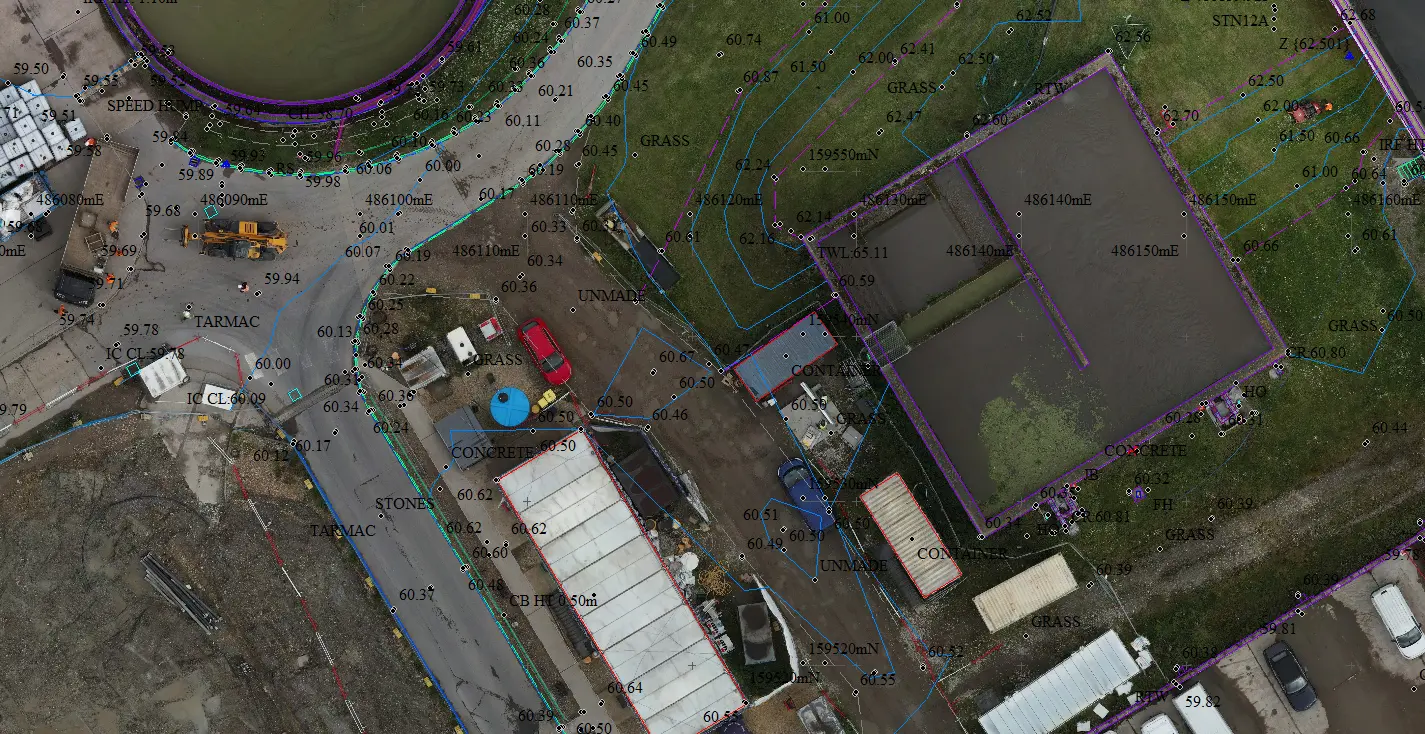
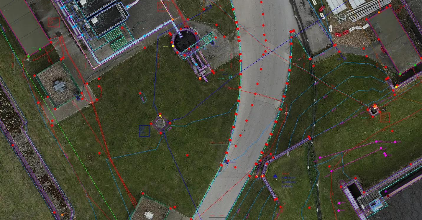
Using a 2D orthomosaic from a drone survey is a great way to bring line work from a topographical or utility CAD drawing to life as it gives great insights and perspective plus provides context.
Not everyone can read a 2D CAD drawing so using the 2D orthomosaic as a layer is very helpful.
This is a very useful tool for site inductions, health and safety, logistics, planning, site meetings, ground investigations etc.
All you need to do is import the 2D orthomosaic into AutoCAD or GIS software and overlay the topo or utility drawings (if everything is in the same co-ordinate system).