Efficient
Drone Surveying
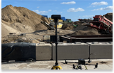
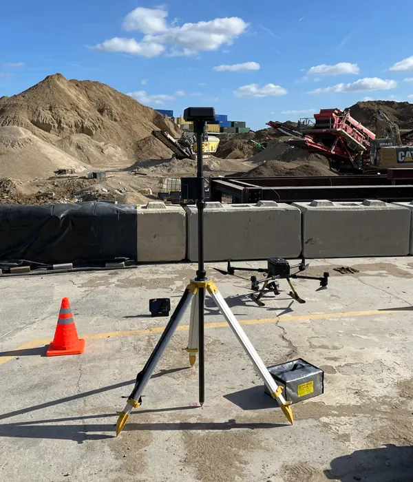
Drone surveying is a modern surveying method that uses unmanned aerial vehicles (UAVs) equipped with high-resolution cameras, LiDAR sensors, and positioning systems to capture accurate spatial data from above. Drone surveying is now widely used across construction, infrastructure, utilities, and environmental projects due to its speed, safety benefits, and high levels of accuracy.
Compared to traditional land surveying methods, drone mapping can cover large or complex sites in a fraction of the time often without the need for road closures, working at height, or accessing hazardous locations.


What Is a Drone Survey?
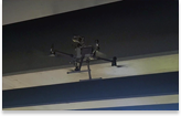
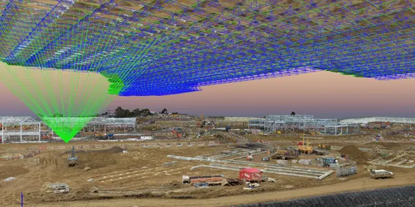
A drone survey involves flying a programmed drone over a site or building to capture overlapping aerial imagery or LiDAR data. The drone follows predefined flight paths to ensure consistent coverage and data quality.
During the flight, the drone collects:
- High-resolution aerial photographs
- 3D spatial data
- Elevation and terrain information
- Asset and feature detail
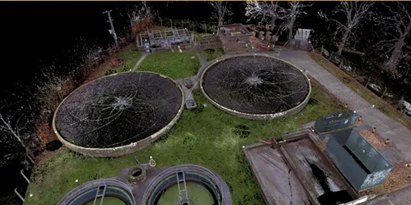
This data is processed using specialist photogrammetry or LiDAR software to create accurate digital models such as orthomosaics, point clouds, digital terrain models (DTMs), and 3D surfaces.
Drone surveying is commonly referred to as UAV surveying or aerial surveying, and is now recognised as a reliable surveying method across the UK construction and engineering sector.
How Can I Use the Data From a Drone Survey?
The data generated from a drone survey is highly versatile and can be used across multiple project stages.
Common deliverables include:
- Orthomosaic maps for accurate site measurements
- 3D models for visualisation and design coordination
- Topographic surveys for engineering and planning
- Digital Terrain Models (DTM) and Digital Surface Models (DSM)
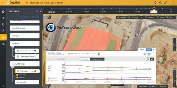
- Volume calculations for earthworks, stockpiles, and cut/fill analysis
- CAD and BIM integration for AutoCAD, Civil 3D, Revit, and GIS platforms
Drone survey data supports improved decision-making, reduces rework, and provides a permanent digital record of site conditions at a specific point in time.
Is a Drone Survey Accurate and Can It Be Linked to the OS Grid?
Yes when correctly planned and executed, a drone survey can achieve survey-grade accuracy and be fully linked to the Ordnance Survey National Grid (OSGB36).
Modern drone surveys typically use:
- RTK or PPK GNSS positioning
- Ground Control Points (GCPs)
- Accurate coordinate transformation to OS grid
Typical drone survey accuracies include:
- Horizontal accuracy: ±1–3 cm
- Vertical accuracy: ±2–5 cm
This makes drone surveying suitable for engineering design, planning submissions, flood modelling, and construction measurement. All outputs can be delivered in OS grid coordinates and aligned seamlessly with existing topographic or design datasets.
How Much Does a Drone Survey Cost?
The cost of a drone survey depends on several factors, including:
- Size of the site
- Required accuracy
- Type of data (photogrammetry or LiDAR)
- Deliverables required
- Access constraints and airspace considerations
In the UK, drone surveys are typically more cost-effective than traditional surveying methods, particularly for large or difficult-to-access sites.
As a general guide:
- Medium sites may start from £1,500
- Larger construction or infrastructure sites are priced based on area and outputs
Drone surveys often reduce survey time by 60–80%, delivering faster results while significantly improving site safety.
Why Choose Drone Surveying?
Drone surveying provides clear advantages:
- Faster data capture
- Reduced site risk
- Minimal disruption to live environments
- High-accuracy georeferenced data
- Repeatable surveys for progress tracking
As technology continues to advance, drone surveys are becoming a standard tool for modern surveying, replacing or supporting traditional ground-based methods across the UK.