Airborn
Aerial LiDAR Survey
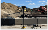
LiDAR mapping has rapidly become one of the most accurate and efficient methods of capturing high-resolution terrain and asset data. When combined with drone technology, LiDAR mapping enables surveyors, engineers, and infrastructure owners to collect precise 3D information safely, quickly, and cost-effectively — even in complex or vegetated environments.
Using advanced systems, drone-based LiDAR surveys now provide survey-grade accuracy without the need for extensive ground access or traditional boots-on-the-ground methods. Traditional methods can be used to capture terrain data not picked up from our LiDAR drone survey services.

What is a LiDAR Survey?
LiDAR surveying (Light Detection and Ranging) is a remote sensing method that uses laser pulses to measure distances between a sensor and the ground or surrounding objects.
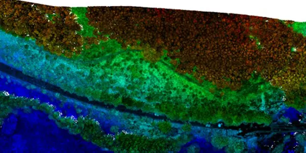
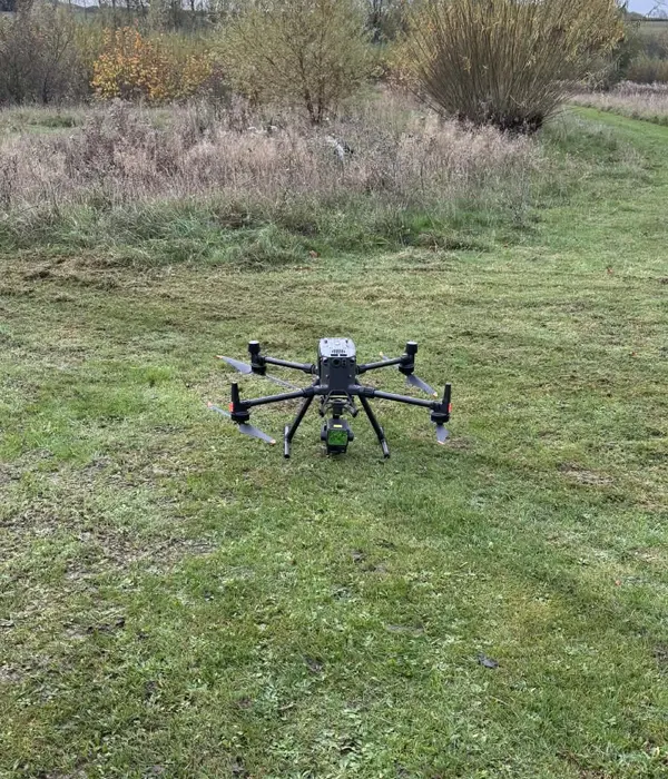
During a LiDAR survey, thousands to millions of laser pulses per second are emitted from a LiDAR sensor mounted to a drone. These pulses reflect off surfaces such as ground, vegetation, buildings, and infrastructure before returning to the sensor. By calculating the time taken for each pulse to return, highly accurate 3D point cloud data is created.
Unlike traditional photogrammetry, lidar surveying can penetrate vegetation, making it ideal for mapping ground levels beneath trees, hedgerows, and dense growth.
How Does LiDAR Mapping Work?
LiDAR mapping using drones follows a structured workflow:
Flight planning – Survey parameters are defined including altitude, overlap, and scan density.
Data capture – The drone flies automated flight paths carrying LiDAR sensors, collecting laser returns alongside GNSS and IMU data.
Position correction – High-precision GNSS (often RTK/PPK) corrects the drone’s exact position during flight.
Point cloud generation – Millions of XYZ points are processed into a 3D point cloud.
Classification and modelling – Data is classified into ground, vegetation, buildings, and structures, allowing creation of DTMs, DSMs, contours, and CAD-ready outputs.
This approach allows accurate surveying without traffic management, confined-space entry, or working at height.
How Much Does LiDAR Mapping Cost?
The cost of LiDAR mapping depends on several factors:
- Site size and terrain complexity
- Required accuracy and point density
- Deliverables (DTM, contours, CAD files, BIM integration)
- Access constraints and flight permissions
Drone based LiDAR surveying typically costs significantly less than traditional ground surveys, particularly for large, remote, or hazardous sites.
As a general guide:
- Small sites may start from £1,000–£2,000
- Larger infrastructure corridors or multi-hectare surveys are priced based on area and outputs
Crucially, drone LiDAR often delivers time savings of 50–80%, reducing project delays and overall construction risk.
What Is LiDAR Mapping Used For?
LiDAR mapping is widely used across infrastructure and environmental sectors, including:
- Topographic and terrain surveys
- Flood modelling and drainage analysis
- Highway, rail, and corridor surveys
- Earthworks volume calculations
- Forestry and vegetation management
- Construction progress monitoring
- Quarries, landfills, and aggregates
- Asset condition assessment
Because LiDAR can see through vegetation, it is particularly valuable where photogrammetry cannot provide reliable ground data.
How Good Is LiDAR Data and What Are the Accuracies?
Modern drone LiDAR systems deliver survey-grade accuracy when correctly deployed. Typical performance includes:
- Vertical accuracy: ±3–5 cm
- Horizontal accuracy: ±2–5 cm
- Point density: 100–300+ points per m² (depending on flight height and speed)
This level of accuracy makes LiDAR suitable for engineering design, flood risk modelling, and detailed terrain analysis.
Additionally, LiDAR provides consistent results across varying light conditions, shadows, and surface textures a major advantage over optical imagery.
For infrastructure, construction, utilities, and environmental projects, lidar surveying offers a faster, safer, and more reliable alternative to traditional methods while delivering measurable value from day one.