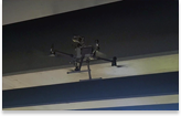
We carried out a 3D point cloud survey of the Portsmouth Naval Memorial using drone technology and total station, capturing an unbelievable amount of detail and resolution.
This level of detail is very useful when it comes to identifying defects. The orthorectified images and 3D point cloud can be used to produce detailed 2D cad plans. The model was tied to the OS grid.
These plans can be used to markup defects while the photogrammetry based 3D model can be used to inspect the condition of the stonework and pointing.
Using a combination of technologies to accurately record and model heritage structures is highly beneficial.