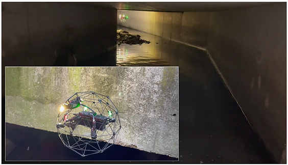
We carried out a visual inspection and survey of a culvert using a confined space drone combined with 3D digital data from a terrestrial laser scanner.
We provided our client with detailed HD images/video on the condition of the structure plus a colourised 3D point cloud tied to the OS grid. This allows the digital data to be tied to other datasets e.g. an above ground 3D model or point cloud.
News
Stay informed with our news
Services
Sectors
Company
22 Burkes Road, Beaconsfield, England, HP9 1PF
Mobile: +44 (0)7805 864642
Email: info@prodroneworx.co.uk