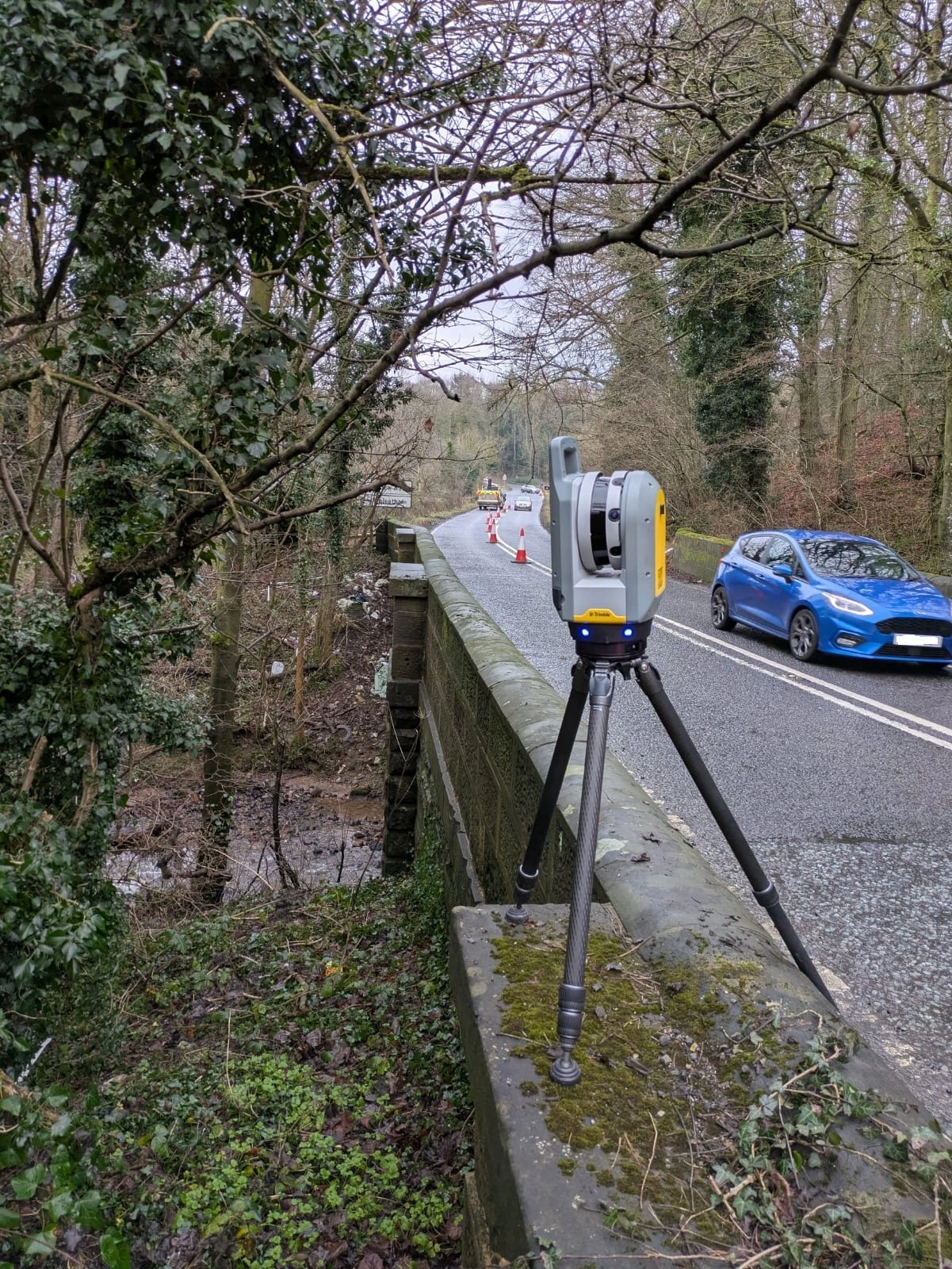
When people hear the name ProDroneWorx, they often assume every project starts with a drone. This one didn't. For a recent highway project our client needed survey data with a height accuracy of ±10mm on hard surfaces, plus detailed geometry of a bridge, including its underside. That called for ground-based topographical surveying and terrestrial 3D laser scanning.
The result was a complete set of survey deliverables, captured to the RICS Specification for Surveys of Land, Buildings and Utility Services at scales 1:500 and larger (3rd edition), Accuracy Band D.
The brief
The client set out a clear, three-part specification:
1. Highway topographical survey extending approx. 1km, capturing road markings, kerb lines, gullies, inspection covers (not lifted), road signage, and up to 5 metres beyond the kerb line (vegetation outline only). The survey also extended 10 metres upstream and downstream of the bridge.
2. 2D and 3D topographical survey deliverables, including a DTM (digital terrain model) mesh, covering 1km of road, with five permanent ground markers installed for future reference.
3. 3D laser scanning of the bridge, producing a point cloud of the top, underside, and east and west elevations.
Why we left the drones at home
We operate drones every week, and for many topographical surveys aerial capture is the fastest and most cost-effective option. But a good survey starts with the specification, not the equipment.
Three factors made ground-based methods the right choice here:
• Tight height tolerance. RICS Band D calls for ±10mm height accuracy on hard surfaces. Meeting that on a road surface reliably requires instruments working directly from established survey control.
• Kerb-level detail. Kerb upstands, gully grates, inspection covers and road markings are small features where precision matters for highway design and drainage modelling.
Topographical survey: road corridor and junction
This was a live highway, so we planned it like one. Traffic management was in place throughout, allowing our team to work safely at kerb level while keeping road users moving.
Our team established a survey control network along the corridor and installed five permanent ground markers. These give the client a fixed, re-occupiable reference frame, so future surveys, setting-out and monitoring can be tied back to the same coordinates,
From that control we captured the full road corridor: kerb lines, carriageway edges, road markings, gullies, inspection covers, signage and the outline of vegetation up to 5 metres beyond the kerb.
The data was processed into:
• a 2D topographical survey drawing suitable for highway design, and
• a 3D topographical survey model with a DTM mesh, giving designers an accurate ground surface for levels, drainage falls and earthworks calculations.
3D laser scanning: the bridge
For the bridge, we used terrestrial 3D laser scanning to capture a dense, registered point cloud of the deck top, the underside, and both the east and west elevations. The scan also covered the watercourse corridor 10 metres upstream and downstream, tying the structure into the surrounding topography.
A point cloud records the structure as it actually stands, not as the original drawings say it should. Engineers can take measurements, cut sections, check clearances and build models from it without returning to site.
What the client received
• 2D topographical survey drawing of the junction and approaches
• 3D topographical survey model with DTM mesh
• Registered 3D laser scan point cloud of the bridge
• Five permanent ground markers with coordinated reference data
• All work delivered to RICS Accuracy Band D (±10mm height on hard surfaces)
More than a drone company
This project reflects how ProDroneWorx works: we match the method to the outcome. Depending on the asset and the accuracy required, that might be aerial drone survey, confined-space inspection, terrestrial 3D laser scanning, LiDAR, traditional topographical survey, or a combination of them. What stays the same is the deliverable: accurate, usable data that engineers and asset owners can design from.